
Community Evacuation Route Maps
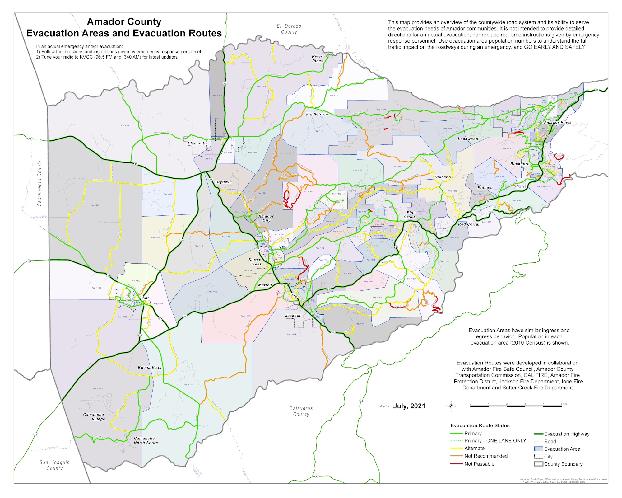
The Amador Fire Safe Council’s vision for this project is to have every ingress and egress route (west of Dew Drop Rd. in Amador County) mapped, understood (by residents and fire agencies) and safely cleared in preparation of wildfire. In the summer of 2019, the AFSC developed the Amador County Evacuation Route Committee, inviting partners and community members to start developing mapping that identified evacuation routes within the county, prioritized roadways needing clearing, and provided education to residents regarding routes. CAL FIRE, Amador Office of Emergency Services (OES), Amador Fire Protection District, all other fire protection districts in the County, and the Amador County Transportation Commission (ACTC) worked together to identify evacuation routes for the county west of Dew Drop, which is the most heavily-populated wildland-urban interface (WUI) zone. In
addition, the ACTC is able to identify the number of residents within each traffic-shed to assist fire agencies and OES if evacuation is necessary.
The maps developed serve several purposes and an important aspect of this is that they are currently being used for emergency response.
Amador - Countywide Map (with QR codes).pdfAmador City - Downtown.pdfAmador City.pdfAmador Pines.pdfBuckhorn.pdfBuena Vista.pdfCamanche.pdfDrytown.pdfFiddletown.pdfIone - Downtown.pdfIone.pdfJackson - Downtown.pdfJackson.pdfLockwood.pdfPine Grove.pdfPioneer.pdfPlymouth - Downtown.pdfPlymouth.pdfRed Corral.pdfSutter Creek - Downtown.pdfSutter Creek.pdfVolcano.pdf